A Walk in Langcliffe and Winskill
Dog-friendly trek in Langcliffe and Winskill
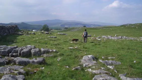
This is a gem of a walk, starting in a picturesque village and quickly taking you up amongst some very scenic limestone hills littered with interesting rock formations and high crags. In the warmer months this is an ideal walk on which to take along a picnic and take time out to sit and enjoy the many views.
Langcliffe is an attractive little place and at weekends there is often something going on in the church or chapel near to the car park, usually involving tea and cakes. Trading started early around Langcliffe. Stone axes from Langdale, in the Lake District, have been found in the area, and in the Victoria Cave, above the village in Langcliffe Scar, were found a fragment of marble from Italy and coins that had been minted in the Roman provinces.
The limestone rocks in this area provide growing habitats for a wide range of plants that are rarely found elsewhere. The route passes through the edge of Winskill Stones Nature Reserve and if you look closely in the grass in spring and summer anywhere on this walk you will doubtless soon find a selection of wild flowers. It would be worth carrying a reference book and checking out your finds – but please don’t pull them up.
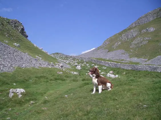
As you are walking on limestone there is little or no surface water so it would be a good idea to take some water for your best friend on warm days. Your dog is going to enjoy the open spaces and most of the paths and tracks down from Winskill are safe enough (and sheep free) so you can take off the lead.
The Walk
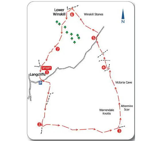
1 From the main car park in the village, cross the road and turn left and walk up the lane about 30 yards to the signpost to Settle on the right. Go through the gate and climb up to the top of the field, turning right after going through the gate at the top. Keep in this same (southerly) direction and eventually the path runs alongside a dry stone wall with overhanging trees on your right. Ahead extensive views over Settle soon open up. Keep on the path up to and through a gate, heading in the same direction.
Crossing the next field a ladder stile appears in the corner ahead but luckily there is also a gate to the left to get through the wall. The path now merges with a wider bridleway (from Settle to Winskill) heading downhill. This bridleway is often used by mountain bikers, so keep a look out for your best friend’s safety. Going through the gate across the bridleway continue until a signpost on the left, showing ‘Malham 5 miles’, indicates it is time to start climbing again.
“Dramatic”
2 Follow the path uphill and soon over a crumbled dry stone wall. The path now curves upwards to become a wide green track. As you get higher you can see ahead (on a clear day) a trig point near Warrendale Knotts. At this point you can also see Pen-y-Ghent in the far distance over to your left. Keep climbing up to the dry stone wall and turn right with the path (keeping the wall on your left). The broad green path takes you up to a damaged gate that at the time of writing was passable either by stepping over it or squeezing through the stile on the left. After the gate the path divides but either route leads you to the same place. The limestone rock formations of Warrendale Knotts on your left now get really interesting and more dramatic as you start to head gently downhill.
In the valley ahead there is a clear divide in the landscape where the limestone ends and over to the right the gritstone of the Scosthrop Moors begin. The much darker acid grassland and rough pasture dominating Scosthrop Moors stands in sharp contrast to the grey/white crags and bright green grass on the limestone.
The two paths soon merge again and run down to a dry stone wall with a ladder stile. Luckily there is a hole in the wall about 70 yards off to the left to get your dog through if it’s not happy with the (relatively low) stile. Walk ahead up to the signpost on the right and then bear left in the indicated direction of Victoria Cave, ½ mile.
“Impressive view”
3 The path now climbs left up the hill with the dramatic Attermire Scar ahead and right. Follow the path over boulder-strewn grass up to and through a gate in the dry stone wall, then turning left to continue upwards. The path soon levels off and now the rest of the walk involves little or no climbing so you will have lots of time to look around and enjoy the scenery. The wide green lane runs under the Attermire Scar to your right with equally interesting rock formations on your left.
The path now heads to the right when a dry stone wall crosses between the hillsides. Walk on through a number of gates as you skirt the foot of the crags. There are signs further along for the Victoria Cave with a mixed message telling you where it is but not to go too near it! The entrance is large and you can get an impressive view without actually going in (keep your best friend under control here). Continuing along the main route, a gate leads to a junction with a wide gravelled track. Turn sharp left and go through the gate heading downhill.
“Gentle descent”
4 This track leads down to Langcliffe (offering an escape route if the weather turns). A little way down the track take the first ‘green’ path to the right, crossing the field and leading eventually to the first and only ladder stile that is not easy to get round. Take care getting yourself and your dog over this (at the time of writing part of the wall has crumbled away and my Springer could get up and over the stile quite easily). Once over continue in the same direction on the broad green track as it now starts a gentle descent away from the limestone heights. Soon a metalled road comes into view and the path heads towards the cattle grid on the right.
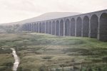
5 Go round the cattle grid and continue on the roadside for 100 yards before turning left down the lane signposted for Stainforth, 1¾ miles. Opposite the lane is a small car park with an information board with details about the Winskill Stones Nature Reserve that covers the area above and behind the car park. It is worth a read and also maybe a detour to explore some of the area. Walking down the lane to the hamlet of Upper Winskill on a clear day you can see Ingleborough, one of the Three Peaks, on the horizon.
“Pleasant footpath”
6 When you reach Upper Winskill, the signpost seems to point in more directions than there are paths! However, you want to turn left down the signposted direction to Langcliffe, going through a gate signed Lower Winskill. Continue down this lane until a signpost on the left indicates a footpath to Langcliffe. Go through the gated stile and cross the field, heading for the corner opposite where a gate and stile lead into a very pleasant footpath with fine views of Langcliffe, lower down the valley.
7 Keep heading down and the path levels out, leading eventually to a lane between dry stone walls. Follow this lane all the way into Langcliffe; turning left at a crossroads with another lane will lead you into the back of the car park.
Need to Know:
Terrain:
Footpaths (some rough in places), green tracks, and paths through meadows. Short steep ascents/descents in a couple of places. As it is limestone country (and thus well drained) the walking is seldom muddy.
Where to park:
There is a reasonably-sized free car park next to the church in Langcliffe that seldom fills up (GR SD822651). Alternatively the roads in the village are quite wide and there are plenty of parking places without blocking off access for residents. Maps: OS Explorer OL2 Yorkshire Dales: South & West, Harvey Outdoor Yorkshire Dales: Dales South.
How to get there:
Travelling from the east or west along the A65 take the road into Settle (B6480 both directions). Continue through the centre of Settle and after passing under the railway arch on the way out again take the signposted road (B6479) to Langcliffe and Horton-in-Ribblesdale. Follow this for about ²/3 mile and turn right at the first sign for Langcliffe. Follow this (Main Road) through the village until you see the car park just opposite the church. Travelling south down Ribblesdale, turn left at the Langcliffe signpost and follow this road (New Street) until it runs into Main Street. Turn left here and continue up to the car park opposite the church.
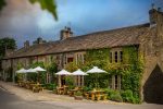
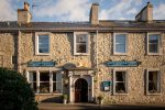
Nearest refreshments:
There are no refreshment facilities in Langcliffe but plenty in nearby Settle. Try the Singing Kettle Tearoom in the Market Place telephone: 01729 823125, or the Settle Down Café at 11 Duke Street telephone: 01729 822480.
Dog Factors:
Distance: 3 miles.
Road walking: Limited to a short stretch getting out of Langcliffe and about 100 yards on a very quiet lane.
Livestock: Sheep graze in nearly all the fields
Stiles: Plenty of these and all but one are easily negotiated. There is just one ladder stile over which your dog might require carrying.
Nearest vets: Dalehead Veterinary Group, Settle.
‘Yorkshire Dales – A Dog Walker’s Guide’ by Rob Godfrey is available from countrysidebooks.co.uk