A Dales High Way – Saltaire to Appleby-in-Westmorland
A Dales High Way, a new 143-kilometre route, traverses the stunning Yorkshire Dales from south to north, winding between market towns and villages and up over beautiful limestone hills. Unlike its better-known sibling, the Dales Way, it takes a high route across the countryside, tempting the walker to at least one peak on the fells on each day of walking. The trail, which was conceived by local walkers Tony and Chris Grogan in 2007, leads from Saltaire to Appleby-in-Westmorland and runs roughly parallel to the Settle–Carlisle Railway, enabling easy access to sections of the route from the railway.
Stepping off the train at Saltaire, you’re immediately confronted with Salts Mill, Titus Salt’s utopian mill, built with a vision of a better life for workers in Bradford’s brutal textile industry. A working mill until 1986, it now houses many of local painter David Hockney’s works, as well as shops and cafes. The route begins along the Leeds and Liverpool Canal but soon rises over the moors above Ilkley, passing the Twelve Apostles stone circle and the cup and ring Swastika Stone.
Skipton, the gateway to the Dales, is a charming market town with a twelfth-century castle. If you’re lucky enough to pass through on market day, you can stock up for lunch with freshly baked bread and local cheeses. The route leaves Skipton with a stiff climb up the conical Sharp Haw.
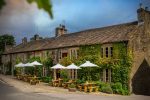
If you lift your eyes skyward, you may be fortunate enough to glimpse a red kite – these birds were successfully reintroduced to the area in the late 1990s. You’re never far on this route from the next tearoom where you can wash a slice of ginger parkin or curd tart down with a warm cup of strong Yorkshire tea. The area is also home to dozens of breweries – from the long-established Timothy Taylor to newer companies such as Saltaire Brewery. The Angel at Hetton, one of England’s first gastropubs, won a Michelin star in the 2020 Michelin Guide, although you may need a brush and polish after a day’s walking if you want to experience their award winning food.
Heading for Malham Cove
© SKYWARE PRESS
“Breathtaking cliffs”
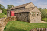
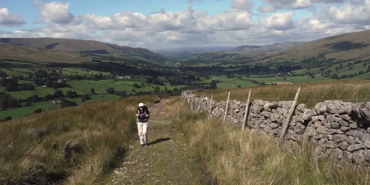
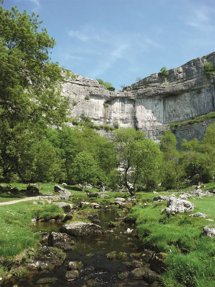
The Dales is walking country, and you’ll find an abundance of bed and breakfasts, willing to dry your boots after a day in the hills. The hardiest of walkers will find plenty of camping spots on the route. At Malham, you might manage to squeeze into the always-popular Youth Hostel before your climb up Malham Cove. It is here that you will encounter the breathtaking cliffs, pavements and caverns of limestone country that so characterises the Dales.
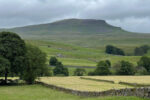
At Settle, you might want to fortify yourself for the coming climb with a pitstop at Ye Olde Naked Man Cafe and Bakery. From Settle, A Dales High Way passes Stainforth (and the popular wild swimming spot of Stainforth Force) before entering Yorkshire Three Peaks country. The Yorkshire Three Peaks form a popular challenge route, that walkers aim to complete in under twelve hours, over Pen-y-Ghent, Whernside and Ingleborough – you can choose to take a variation to complete this challenge, although you might instead take the easier option and climb over Ingleborough and skirt the base of Whernside.
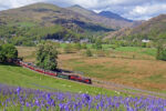
Whichever way you decide to follow, the highlight of this section is the imposing Ribblehead Viaduct coming into view – you may even be fortunate enough to catch a glimpse of one of the steam trains that occasionally pass up and down the railway. In Chapel-le-Dale, you can see a memorial to more than 200 people who died during the construction of the railway from accidents or smallpox outbreaks – the churchyard here had to be extended to accommodate the unfortunate navvies, as well as their wives and children.
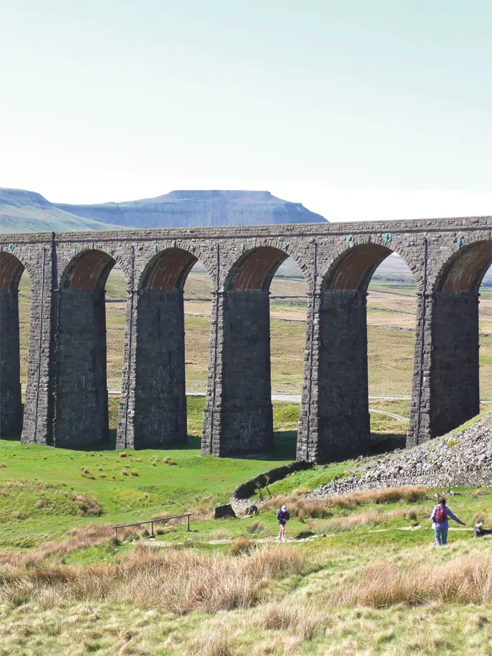
Ribblehead viaduct with Ingleborough Behind
© SKYWARE PRESS
“Picturesque”
As you climb up over the Howgills, the landscape changes from limestone to slate and gritstone. The Howgill Fells are one of Britain’s best kept secrets, beautiful wild hills so infrequently walked that, even on a bright summer’s day, you might find yourself with only the hardy fell ponies for company. These are not the well-trodden paths and slabbed trails of the Lake District, but grassy trods across green giants. At the top of The Calf, the Howgills’ highest point, on a clear day you can enjoy a panoramic view of the Lake District, and the Dales that you have just conquered.
Even as you near the finish, A Dales High Way still has surprises to delight you with – the bird-rich Sunbiggin Tarn, and then the expansive limestone pavement of Great Asby Scar. This area of Cumbria is one of the few remaining strongholds of the native red squirrel and, as you reach the Eden valley, you may glimpse them near the old mill at Rutter Force or in the grounds of Appleby Castle (now luxury accommodation and a popular wedding venue, although tours of the castle are available).
The route ends at the picturesque market town of Appleby, (in)famous for the Horse Fair, but at other times of year, an attractive Cumbrian agricultural town. You can claim a certificate of completion at Appleby’s Tourist Information Centre. If you have time to spare at the end of your trip, you might want to climb nearby Cross Fell, one of England’s highest peaks, and follow the Pennine Way along the ridge to the golf ball on Great Dun Fell.
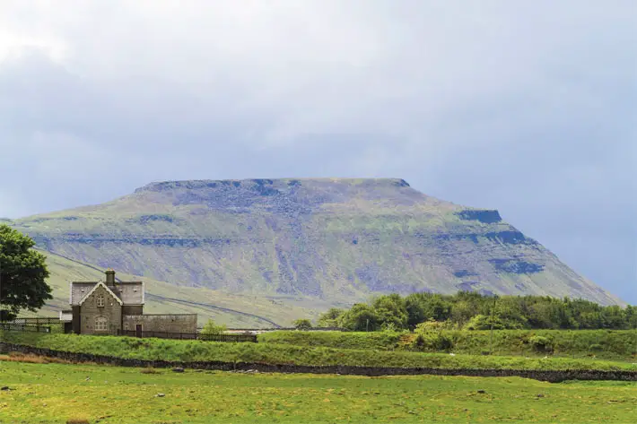
Ingleborough viewed from Ribblehead Viaduct
© JOHN COEFIELD
“Brightest and most beautiful”
Appleby is a stop on the Settle–Carlisle Railway, and A Dales High Way is most easily started and finished by rail; the Settle–Carlisle Railway is one of the highest and most beautiful in the United Kingdom. Saltaire is on the Airedale line, well served by trains from Leeds and Bradford; Leeds Bradford Airport is the closest international airport, and Leeds is well connected by rail to other cities (London is approximately two hours and fifteen minutes away).
Yorkshire is God’s own country, and the weather can feel apocalyptic. The walk may be attempted at any time of year, although winter conditions and short days present a challenge from October to April. Sunshine is never guaranteed and, as the route passes through high exposed moorland, be prepared for icy, freezing conditions in winter and rain and wind in summer. Even with a bright start, the peaks may still be obscured in mist. There is no surface more slippery than limestone pavement after a downpour, and it’s worth remembering that a slathering of bog does wonders for the skin. But the verdant lushness of the Eden Valley, the timelessness of drystone walls lining high pastures, the sparkling waterfalls, and the wide blue bird-strewn skies will make you fall in love with this high route over the Dales.
In spring you crush wild garlic in bluebell-rich woods, and in summer the moors glow purple with heather. On a fine day, this may be the brightest and most beautiful countryside you’ll encounter in England.
TRAIL ESSENTIALS
Start: Saltaire, West Yorkshire, England
End: Appleby-in-Westmorland, Cumbria, England
Distance: 143km
Ascent/descent: 3,770m/3,690m
HOW TO GET THERE
Saltaire is on the Airedale railway line, which connects to Leeds (where connections can be made to London, or coach connections to Leeds Bradford Airport).
Appleby is on the Settle–Carlisle Railway – there are direct rail connections from Settle to Leeds.
TIME TO COMPLETE
Walking: 8 days/46 hours
Trekking: 5 days/37 hours
Fastpacking: 4 days/28 hours
Trail running: 3 days/20 hours
 PROS
PROS
• The Howgills – those that drive up the M6 to the Lake District may notice the Howgills on the other side of the motorway, but few stop to explore these green and golden fells. These tranquil hills, beloved by Alfred Wainwright, are Cumbria’s best-kept secret.
• Settle–Carlisle Railway – this iconic railway, once puffed over by the Hogwarts Express, is known as one of Britain’s highest and most spectacular routes. Many walkers choose to complete A Dales High Way and then enjoy a train ride back across the landscape they have just traversed.
• Geology – high on the moors, you’ll pass the popular limestone pavement at Malham and a quieter twin near Great Asby. The Howgills have a distinctive Silurian sandstone that distinguishes their topography from the softer southern Dales and the jagged peaks of the Lake District.
CONS
• Mist – the Howgills may often offer beautiful views of the Lake District but, as often as not, you will find the summit views and grassy trods obscured by mist.
• Tourist hotspots – while much of A Dales High Way crosses quiet moorland, spots like Malham and Ribblesdale can attract thousands of daytrippers on sunny summer’s days.
• Appleby Horse Fair – in early June, Appleby Horse Fair attracts approximately 10,000 members of the travelling community, and 30,000 other visitors to the small market town. Some local businesses close during the Fair. You are likely to experience difficulty finding accommodation and other services should your arrival in Appleby coincide with the Horse Fair.
GOOD TO KNOW
While the route only passes over Ingleborough, many walkers take a variation to complete all of the Yorkshire Three Peaks – Ingleborough, Whernside and Pen-y-Ghent. Every year, thousands attempt the Yorkshire Three Peaks route, including participants in one of England’s oldest fell races, the Three Peaks Race – Andy Peace holds the men’s record (two hours and forty-six minutes) and Victoria Wilkinson the women’s (three hours and nine minutes).
Article taken from ‘Big Trails: Great Britain & Ireland’, edited by Kathy Rogers & Stephen Ross is published by Vertebrate Publishing, £17.99 paperback
Top image: Leaving Dentdale on the northern slopes of Whernside © SKYWARE PRESS