Dent, Deepdale & The Dee Yorkshire Walk
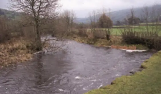
A Circular Walk Around Dentdale
The seclusion of Dentdale is one reason why it is a favourite area for many lovers of the Dales. Access to the valley is not easy by road, but the cobbled streets and whitewashed cottages of Dent are a great attraction. Dent station, at 1,132 ft above sea level the highest main-line station in England, is four miles from the village, and interesting to visit. This walk uses some of the pleasant footpaths from the village and provides views of the green valley which will stay in the memory. From Tommy Bridge you see the valley of Deepdale and the walk along the Dales Way by the River Dee back to Dent is always a treat.
Distance – 4 miles.
OS Explorer – Outdoor Leisure OL2, Yorkshire Dales, Southern & Western areas.
GR 705870.
Starting point – The Sun Inn at Dent.
How to get there – Dent is reached off the A683 near Sedbergh. In Barbon village look for the signs to Dent. From the B6255 Ingleton to Hawes Road, turn west 5 miles north of Ribblehead. There is a village car park.
“Enclosed track”
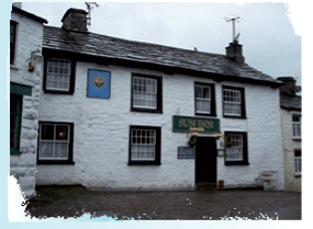 The Pub – ‘The Best Ales & Food under the Sun’ proclaims the sign outside the Sun Inn. After sampling its hospitality you will probably agree, the no-nonsense bar food includes home-made soup, a big basket of chips, and beef or cheeseburgers. On the blackboard for the ‘Meat Eaters’ Specials of the Day’, I noticed sausage cassoulet which sounded interesting.
Children have their own menu and curry is popular with the clientele who include campers and caravanners. They are well catered for with an intriguing choice of real ales. Try the local Dent Brewery’s Kamikaze or maybe Oakham Brewery’s Bishop’s Farewell. A real fire will welcome you if the weather is cool. The Sun also offers accommodation. Food is served from 12 noon to 2 pm and 6.30 pm to 8.30 pm. Tel: 01539 625208.
THE WALK
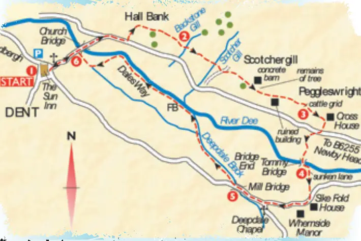
1. From the Sun Inn go down the main cobbled street which becomes a road as you leave the village. Go on and cross Church Bridge over the River Dee. Keep on the road as it bears right and after about 250 yards and an old milepost, turn up a track on the left. The outer sides are concreted, and you reach a farm, Hall Bank. Go to the right in front of the cottages and through a small yard.
“Squeeze stile”
Look for a stile on the right into a field and from here the direction is straight ahead for about a mile. Walk by the wall to a stile at the end. Turn left on a track and continue in front of the houses and barn. Go into a field to a gate and cross a field. Go through a metal gate and turn right on an enclosed track. Walk in front of a house and turn left through a pair of wooden gates. Go right by the Hayloft and over a small footbridge crossing Backstone Gill.
2. Continue on a track enclosed by a hedge and wall. From a gate go right then left on a metalled track. Turn left at a sign up into a field and turn right by a wall, above a property. Go through the stile in the wall ahead and look for the yellow marker ahead, at a squeeze stile in a wall. Turn left to enter a wooded area. There is a slab bridge over Scotcher Gill. Cross a farm track to a stile and go over a field. From a wall stile go to a wooden stile at a slightly lower level by the remains of a large tree.
Cross a field in front of a concrete barn to a large wooden step stile in the corner. Go along the field to the left of a property, note arrow. Reach a wall and a very narrow squeeze above a ruined building. Continue through a field to a stile in the next wall. Go up slightly over a field to a wooden stile. From here join a track serving the property to the left, Peggleswright, a house with a white front facing a long barn.
“Sunken lane”
 3. There is a cattle grid immediately left, but turn right and walk down the track. Keep on this main track and pass Cross House as you go down. Reach the valley road. Cross slightly right and into the farmyard, the signpost reads Cross House Lane. Go through the gate on the left and down to a second gate, do not go through. Follow the sign to Tommy Bridge, going down the field with the hedge on your left. The land is often wet. When you reach a gate accessing an enclosed track continue ahead to Tommy Bridge, spanning the River Dee.
4. Turn left a few yards to a narrow sunken lane and follow this to reach a quiet road. Turn right and go along at first passing Syke Fold then you see Whernside Manor, a Grade II listed building. Next you reach Deepdale Chapel where there are a few gravestones. Over the wall there is a fine view down to Deepdale Beck. Go on a little and the road crosses Mill Bridge.
“Kissing gate”
5. Look on the right for the signpost pointing to Church Bridge and follow the Dales Way route for 1½ miles to Dent. At first you are beside Deepdale Beck until the River Dee joins. As you go along the riverside path you see Dent coming into view. Reach a wide flat crossing from where you go beside the football field to a black kissing gate.
6. Turn left on the road into Dent. Take the gate on the right through the churchyard, there is a war memorial with a moving tribute and the church may be open. Continue on the path and go left for the Sun Inn.
Nearby the granite memorial commemorates Adam Sedgwick, a local boy who became Woodwardian Professor of Geology at Cambridge University. His pupils included the young Charles Darwin.
Places of interest nearby
Dent Village Heritage Centre has an interesting display on the lives of local people through the centuries and many aspects of farming, wildlife and local culture. Tel: 01539 625800. Flintergill Outrake Nature Trail is a short linear walk to a fine viewpoint which starts in the centre of Dent. You can see the ‘Dancing Flags’ which are explained in a leaflet from the Heritage Centre.
Pocket Pub Walks Yorkshire Dales by Peter Young
Published by Countryside Books
countrysidebooks.co.uk
Price £5.99
ISBN: 978 1 84674 086 2

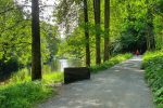
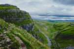





YORKSHIRE WALK: Spring is in the year – here’s a lovely river walk around Dent and Deepdale … http://t.co/jpOiNVelMa #yorkshire