A Circular Walk from Aysgarth Falls, Wensleydale
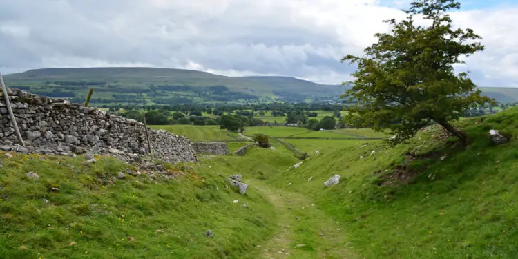
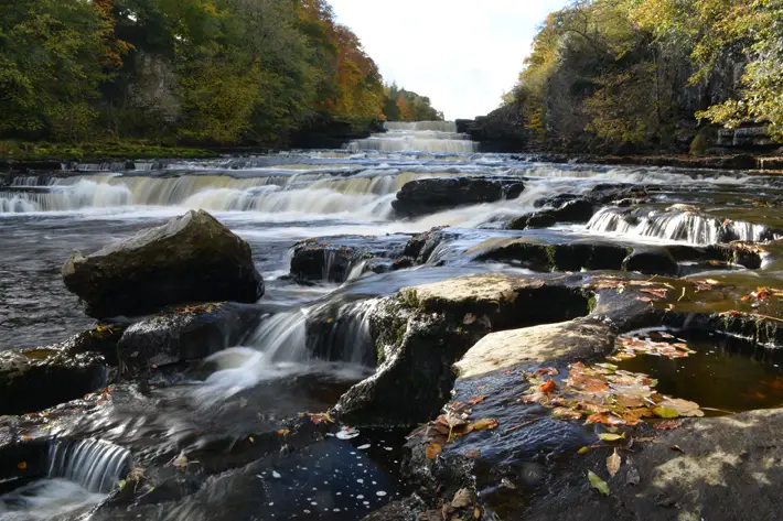
This beautiful circular walk takes in many of the highlights of mid-Wensleydale while offering quiet, peaceful paths away from the crowds in between. Start the day admiring the three separate cascades that make up the spectacular Aysgarth Falls, followed by some lovely walking through classic Dales’ pastures leading up to impressive Bolton Castle. You return to Aysgarth enjoying beautiful views over Wensleydale from the high moors of Bolton Parks and via the pretty village of Carperby. The Wheatsheaf Inn in Carperby provides the chance for a well-earned drink near the end of your walk, before returning across fields to Aysgarth. While not a long walk, you can easily spend all day on this route if you would like to spend some time at the waterfalls and go into Bolton Castle.
DIRECTIONS:
Leave the National Park on the pavement on the right-hand side of the car park entrance (with National Park Centre to your right), signed to ‘Middle and Lower Falls’.
If you would like to visit upper Aysgarth Falls before beginning on the walk route, head out of the car park away from the visitor information centre and down a path between the road and a small wood. The obvious path takes you through a gate and you can soon see and hear the falls on your left hand side. Retrace your steps to the car park.
When the path ends at the road, cross over and enter Freeholders’ Wood through a wooden gate. Stay right (signed ‘FP Lower & Middle Falls 400yds, Castle Bolton 2¾ Ml’), following the well-made path through the woodland. This is a popular path as many people drive to the car park and take this short path to visit the waterfalls. You will soon come to a viewing platform for the Middle Falls on your right down some steep stone steps.
Having seen the falls, carry on ahead through the wood then through a wooden gate into a more open, grassy area. Ignore a footpath signed to Castle Bolton on your left and continue straight ahead on the main path to go down some steps. You soon see a sign to ‘Lower Falls Viewing Point’, pointing right. Do not follow this sign but continue ahead through the wood (as you will be seeing Lower Falls from our preferred viewpoint slightly further on).
As you see a wooden gate and footpath sign ahead of you, there is a gap in the rocks to your right and you can make a short, easy scramble down the rocks (which are slick from heavy use so can be slippery in wet weather) to reach the limestone shelf below the Lower Falls. For us, this is the best view of any of the Aysgarth falls and much quieter than any of the others.
To continue the route, climb back up the rocks and head through the wooden gate, following the footpath sign left to Castle Bolton, which takes you uphill to reach a fence. Here, turn right and follow the fence on your left to a wooden gate, signed to Redmire.
Go through the gate and follow the broad, grassy path across the open field in front of you, aiming for a gate in a small group of trees on the far side.
Go through two gates in quick succession, and then through a third gate as the path leads between a cluster of buildings, with Hollins House on your right. Follow the access road away from the buildings until, just after a metal gate, you see a wooden gate with footpath sign into the field on your right. Follow this path along the right-hand edge of the field and Bolton Castle soon comes into view ahead of you.
“Gorgeous views”
The path takes you through another wooden gate with a footpath sign to ‘Castle Bolton via Low Thoresby 1¾ Ml’. Follow the path diagonally across the next field to reach a small gated stile in the far wall. Here turn right, staying in the same field with the wall to your left, following the sign to ‘Castle Bolton avoiding main road’.
Leave the field through a metal gate and follow the rough track ahead. Where you cross a farm track, keep ahead, following a sign to Castle Bolton and now joining a grassy track, which is soon fenced to your left. After going through another metal gate, the track becomes tree lined (and in places more of a tunnel of trees!). Continue straight ahead along ‘Thoresby Lane’ (still a path, not a road) until you reach Low Thoresby Farm.
Pass the farm to your right and follow the access road away from it until, where the road bends right, there is a footpath sign marked ‘Castle Bolton ½ Ml’ on your left. Follow that path up steps and over a stile to another footpath sign ahead. Follow it to your right, initially up a narrow section of field before opening out and crossing the field half-right to the top corner. Look out for the stile tucked away in the corner of the field (rather than following the track through a wide gap in the hedge). Go through the stile and head straight up along the right-hand side of the next field to reach the road. Castle Bolton is now clearly visible up the hill in front of you.
Cross the main road and take the minor road ahead uphill to reach the castle. It is a bit of a slog but doesn’t take long, and there are good views back to Penhill behind you!
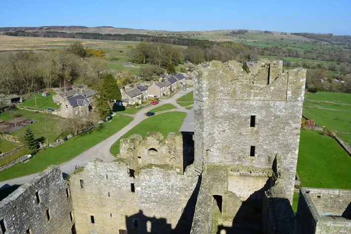
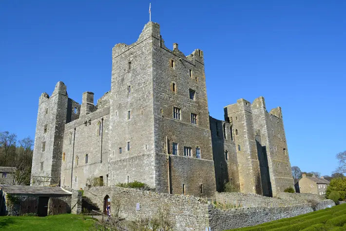
The 600 year old castle sits high above Wensleydale, with gorgeous views down the valley. The castle is definitely worth visiting if it is open and is surprisingly intact inside, with plenty of rooms to explore (as well as a café and toilets, and there are toilets in the small car park for those not going in the café). The castle has a fascinating history and its most famous moment came in 1568, when Mary, Queen of Scots was imprisoned here during Elizabeth I’s reign after her escape from Scotland. The range of chambers in the south-west tower where she is thought to have stayed have been arranged to reflect what they would have looked like during her ‘stay’ in the castle.
The end for Bolton Castle came during the Civil War, when John Scrope, the owner at the time, held the castle for the Royalist cause. Parliamentarians besieged the castle for an entire year, and in November 1645 Scrope was forced to surrender (apparently after the garrison had been reduced to eating their own horses to survive starvation!). Parliament intended to destroy the castle to make it unusable in future, but the south-west tower and the west range survived almost completely intact and habitable, leaving the beautiful medieval castle that we can enjoy today.
As well as the castle, take some time to wander around the charming village of Castle Bolton (the village itself is called ‘Castle Bolton’, and the castle is known as ‘Bolton Castle’!), which is full of traditional Dales’ cottages.
Immediately opposite the castle entrance is the beautiful medieval parish church of St Oswald’s, which is worth popping into. The church dates back to the 14th century and has a lovely stained-glass window in its western gable wall.
“Lovely spot for a break”
To continue the walk, pass between the castle and the church, with the castle car park to your right. Go through a gate and follow the broad bridleway straight ahead, away from the castle, signed ‘Askrigg 7 Ml’ (ignoring the left-hand branch signed ‘Carperby 2 Ml’, unless you want to shorten your route).
Go through another gate and between some mature trees. Follow the clear, broad track ahead as it climbs to follow the edge of the moor and heads west along Wensleydale, with great views to your left over to Penhill and Bishopdale, and down Wensleydale.
After about 1.5km, pass through some slightly run-down farm buildings and continue ahead to where the track takes you through a field gate on the left and then immediately turns right to carry on your westerly course. Here the path turns softer underfoot and you pass through a small cluster of newly planted trees.
Exit the small plantation through a metal gate and follow the track left, signed to Carperby. The broad track now follows a wall on the left and open moor on the right. As the wall bends away to the left, the path continues ahead, crossing a wooden footbridge over Beldon Beck before reaching a gate with a footpath sign to ‘Askrigg 4 Ml’.
The clear, grassy track crosses the field slightly left and has wonderful views down through lower Wensleydale to your left. Leave the field through a wooden gate and take the left-hand fork of the footpath signed to Carperby.
You now begin to descend back into the valley on a beautiful sunken track, with more lovely views over to Penhill, the valleys of Bishopdale and Waldon and the village of Aysgarth on the far side of Wensleydale.
The track soon brings you out onto a wider, stony track, which you follow left and downhill, again signed to Carperby. To your left, you will get good views back to Bolton Castle before going through a gate where the track becomes a tarmacked lane into the back of the village of Carperby. This soon joins the main road through the village. Turn right to reach the village centre, including the Wheatsheaf Inn, which makes a lovely spot for a break, especially at the outside tables on a nice day.
Directly opposite the Wheatsheaf Inn, take the footpath through the gate which is signed to ‘Low Lane ¼ ml’ and takes you through a narrow strip field. About halfway down the field, follow the footpath sign through the gate in the wall on the right and turn left to follow the path straight down the next field, away from Carperby. Another stile at the end will bring you to a narrow lane. Turn right and follow the lane to reach a T-junction.
Here, turn left and follow the road for a few metres before taking a stile through the wall on your right, signed to Aysgarth. Keep to the left-hand edge of the field and exit through another stile into a large field. Follow the footpath sign pointing slightly right.
The path is initially indistinct but once you reach the brow you can see the footpath ahead of you, which crosses an access track and takes you to another footpath sign in the middle of the field. Follow the path past two redundant step-stiles (which now just sit in the middle of the field as the old fences have been removed) to exit the field through a metal kissing gate onto the old railway line.
This is the line of the old Wensleydale Railway, which still runs between Leeming Bar and Redmire. West of Redmire, the line has not been restored but many parts of it make pleasant footpaths. There have long been discussions about extending the working line to the station at Aysgarth, which is just outside the National Park car park.
Cross over the railway line and follow the steps down back into the National Park car park.
NEED TO KNOW:
Start: Aysgarth Falls National Park Car Park
Distance: 7.5 miles (12km)
Height gain: 310m (1,020 feet)
Time: 3.5 hours
OS Map: OL30 – Yorkshire Dales Northern and Central Areas – OS Explorer
Terrain: Mostly easy-going paths over farmland and clear bridleways over the moor.
Refreshments: The Coppice Café at the National Park Information Centre at the start of the walk, Fairhursts at Bolton Castle, the Wheatsheaf pub in Carperby, the Mill Race café on the bridge by upper Aysgarth Falls.
Toilets: In the National Park car park at Aysgarth Falls and at Castle Bolton
Walk supplied by Muddy Boots Walking Holidays, who provide self-guided walking holidays in the stunning Yorkshire Dales, taking the hassle out of planning your trip by arranging excellent accommodation in fantastic country inns and organising transport and luggage transfer.
Muddy Boots also provide Guided Discovery Walks, allowing you to immerse yourself in the beautiful landscape in the company of a knowledgeable local guide.
They are now taking bookings for their covid-friendly walking holidays and self-guided Discovery Walks – for details visit muddybootswalkingholidays.com
