A Walk from Sedbergh Along the River Rawthey
River Walk from Sedbergh
by Dennis and Jan Kelsall
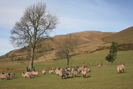
Above Sedbergh, the narrowing valley of the River Rawthey becomes squeezed between the soaring hills of the Howgills and the lower slopes of Rise Hill and Baugh Fell. This undemanding ramble begins across the lower slopes past the castle that oversaw the town’s early development, and returns beside the river by the ruin of a more recent lookout from the 19th century. For a longer day, the route can be linked with Walk 2 to include an exploration of the lower part of the valley.
Directions
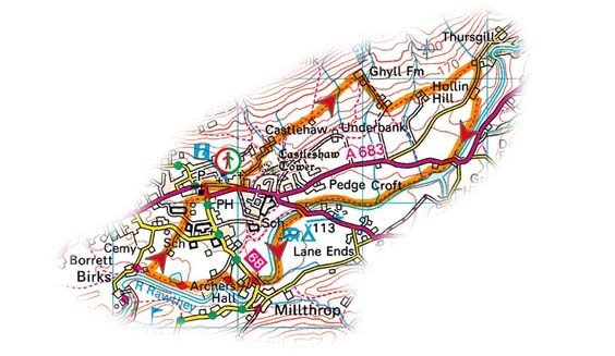
From the junction by St Andrew’s Church, walk east along Main Street through the centre of town. Meeting Long Lane at the end, go left and immediately left again, beside Westwood Books, up a track signed to Castlehaw. Breaking from the trees above the town, the mound of Castlehaw comes into view across to the right. The access is over a stile as the track shortly curves right.
Return to the track and continue to Castlehaw Farm, swinging left in front of the barns and then right across a stream past Howgills Bunk Barn. Through a gate, walk ahead across the fields beyond, contouring above the bottom fence to an isolated barn. Keep going, later crossing a couple of ladder stiles to find the boundary now on your left.
Bounded by the abruptly rising slopes of the Howgills, the views are captivating. Ahead, the great rounded hump of Baugh Fell falls to the foot of Garsdale, while to the right, Frostrow Fells prelude the higher ground of Aye Gill Pike.
Reaching Ghyll Farm, exit through a stable yard and follow its track away to the right. At a fork, just beyond a cattle-grid, bear left into Stone Hill Farm, looking for a small gate in the right corner into a cobbled yard fronting the house. Leave through a field gate at the bottom and walk left at the field edge past the barns. Over a footbridge, continue to the next farm, Hollin Hill.
“Strike out past the mill to enter a small wood”
 Bear left past the farmhouse and through the yard. In the field beyond, bear right across the hillside to a stile. Over a second stile, keep going, later passing the top end of a truncated wall to find a stile just above a white house. Walk down to emerge beside it onto Buckbank Lane.
Turn right to Buckbank Farm and enter the yard. Go right between the barns and then left beside the silage store to the field. Follow the perimeter down and continue above the wooded ravine of the River Rawthey to meet the main road at Straight Bridge.
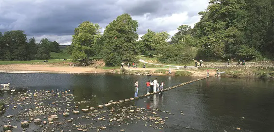
The way continues beside the river through a gap stile opposite to the A684 at New Bridge. Over the Rawthey, turn through a kissing-gate and carry on downstream, emerging by another bridge at Millthrop. Cross back to find a gate, just beyond the drive to Millthrop Mill.
Strike out past the mill to enter a small wood above the river. Watch for the waymarked path swinging right between sunken walls, at the end of which, walk forward and take the right-most of the forking paths to a gate at the edge of the trees. Go left and carry on beyond the corner of the wood and the ruin of an octagonal tower.
“Path falls from the field to rejoin the river”
Known as the Pepper Pot and dating from the end of the 19th century, the tower was a gazebo or summerhouse within the gardens of Akay House. The house was demolished just before the Second World War, but the tower, originally rising to two storeys, was left to crumble in its own good time. The folly became the scene of excitement when a cow wandered in, managing to reach the first floor, and an old photograph shows it gazing bemusedly from the window.
The path falls from the field to rejoin the river, running past one of Sedbergh School’s rugby pitches to a kissing-gate. To carry on with Walk 2, keep ahead up to the path around Birks House to come out on Birks Lane.
Otherwise, swing away from the river, heading upfield towards a barn. Emerging onto a track, follow it out to Busk Lane. Through a kissing-gate opposite, climb to another gate at the top of a rise and, crossing a path, continue beside a sports field. Swing right past the cricket pavilion to come out onto Finkle Street beside St Andrew’s churchyard.
Sedbergh and River Rawthey: Need to know
Start: Sedbergh (SD657921)
Distance: 5 miles (8km)
Height gain: 145m (476ft)
Time: 2hr
Terrain: Field paths and trods
OS map Explorer: OL19 – Howgill Fells & Upper Eden Valley
Refreshments: Pubs and cafés in Sedbergh
Toilets: Beside car parks
Parking: Car parks in Sedbergh (pay and display)
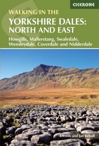
Walk taken from ‘Walking in the Yorkshire Dales: North and East’ by Dennis and Jan Kelsall, published by Cicerone Press, ISBN: 9781852847982
